
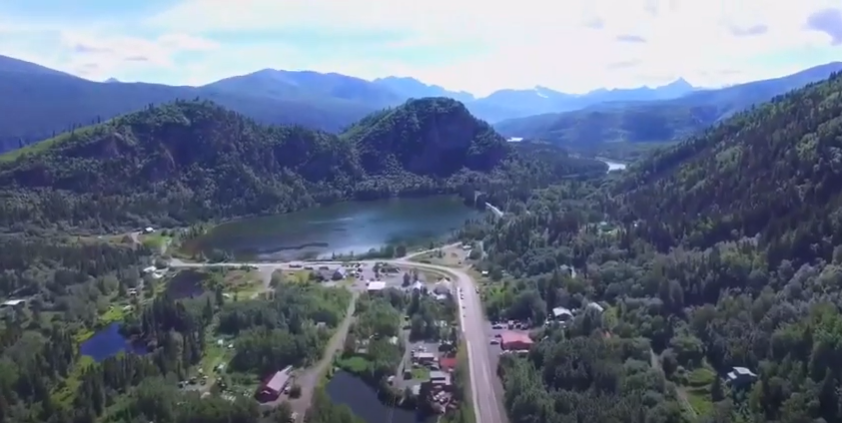
Chitina
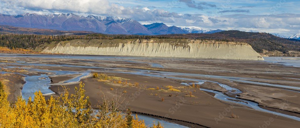
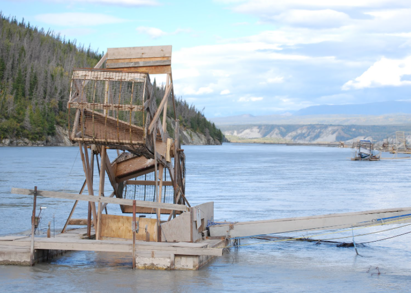
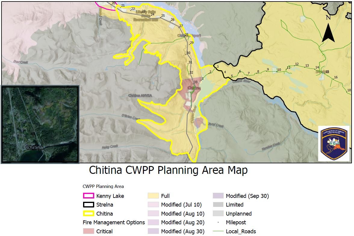
The Chitina Community Wildfire Protection Planning Area covers from mile 20.5 of the Edgerton Hwy to mile 3 of the McCarthy Road. Liberty Falls State Recreation Area, the Chitina Airport, and Chitina Tribal and Community Health Center lie to the north of Chitina. South of Chitina, the planning area includes a heavily used recreation and fishing corridor around O’Brien Creek Rd. extending south to Haley creek and to the east across the Copper River encompassing a culturally sensitive area on the eastern bank. To the east, the planning area follows the Chitina River and connects to the Strelna Planning Area. This eastern area includes a state campground located in a windy area between the confluences of the Kotsina and Chitina Rivers into the Copper River, as well as an AHTNA managed access to floodplains on the Copper and Kotsina River where many fishwheels are present. The community of Chitina contains the Chitina Electric generator facility, multiple businesses, seasonal fishing charter operations, a tribal village with housing and government buildings, store and gas station. The steep canyon in which Chitina lies funnel erratic winds. Vegetation varies from thick matted grass and young growth brush in the community area, surrounded by forested areas of spruce aspen mix forest, areas of black spruce, and dwarf shrub in the sub-alpine higher elevations. Tangles of alder and willow are common along the riverbanks.


CWPP Planning Area Map
Community planning areas include the wildland urban interface (WUI), defined as the area where human development meets and intermingles with undeveloped wildland and vegetative fuels. Included are lands designated as “Critical” and “Full” fire management options. Fire management options are assigned by jurisdictional agencies (landowners/managers), while protection agencies provide fire suppression responsibilities and initial response to wildfires. Alaska Division of Forestry and Fire Protection is the protection agency responsible for fire suppression in the Copper River Basin. See https://forestry.alaska.gov/fire/fireplans for more information on fire management options.
The goal of creating a community wildfire protection plan is to reduce the potential for disaster within the planning boundary by recognizing the hazards, prioritizing areas of protection, and developing a workable action plan with clear goals and objectives to mitigate the risks from wildfire, life, and property.
CWPP DOCUMENT LINK
CLICK BELOW
Please take our online Survey.
Providing feedback on the Chitina Action Plan will ensure your input is captured.
Explore the CWPP Planning Map App. with useful planning layers including CWPP areas, fire management options, land ownership, vegetation layers, and fire return interval models.
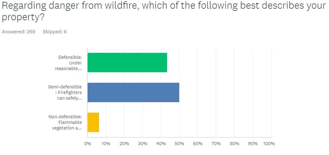
Community Wildfire Protection Plan Survey results:
Thank you for participating


2nd Chitina CWPP Meeting
1st Chitina CWPP Meeting
Notes from past meetings
Community Needs
Emergency Preparedness
Evacuation Plan, Water Silos, Working water pumps, Building for EMS, Heated Ambulance Barn, Classroom space, Wildland EMS training, Communication, Fuel resources for Fire Dept.
Access for emergency Vehicles
Broken down vehicles
Ingress / egress throughout community
Only one access to Village
Clearing around roads
Evacuation rout with signs
Chitina winds high / tourists and camp fire = concern
Communications (Dead Zone)
Community Outreach
Firewise programs, Smokey Bear, signs and posters, home assessments, events, workshops
Education
Community Well
Training
Fuel Reduction
Continue hazardous fuel reduction program, industrial wood chipper, dump truck, dozer
1 mile lake L. side – all big trees beetle kill all dead and down trees (by creek)
Firebreak near O’Bryan Creek area
Hayley Creek / O’Bryan Creek recreation concerns
Treatment and Disposal
Solid waste disposal site and recycling as a sustainable program, industrial woodchipper, biomass utilization
Mountain Spring by John Miller --- is this an available water source? Artesian spring … piping gone … possibility? Seasonal only
Lost lake or other springs by village have been used in past … potential for water source (High elevation )
Hazards Identified
**Dry grasses especially around structures **High concern
High fuel loading on slopes
Topography
Consistent winds
Unsafe burning practices
Tourist/dipnetters
Abandoned vehicles near structures
Not having an evacuation plan
Not having a public emergency plan
Homes and businesses not being “Firewised”
Driveways inaccessible to emergency vehicles
Lack of adequate communications
Communication issues
Open areas have “burn off” of fine fuels yearly
Peat moss – Local knowledge possibility to add on fire hazard map?
Chitina Village Counsel = Large mower & car removal program
**Ingress / egress
** Car Removal big problem
**Weather station that is directly in Chitina
The community of Chitina says that finding people in the area is impossible without detailed directions, especially if unfamiliar. In addition to numbers for housing, signage for summer traffic they think is critical, especially if one is trying to explain to EMS where their emergency is happening.
Boundary Map Input
Down past suzie … O’Bryan Creek / Fox Creek Extend Boundary
Campgrounds
Extend Corridor down past Hayley Creek
Cabin on Tonsina Bluff include