
Glennallen
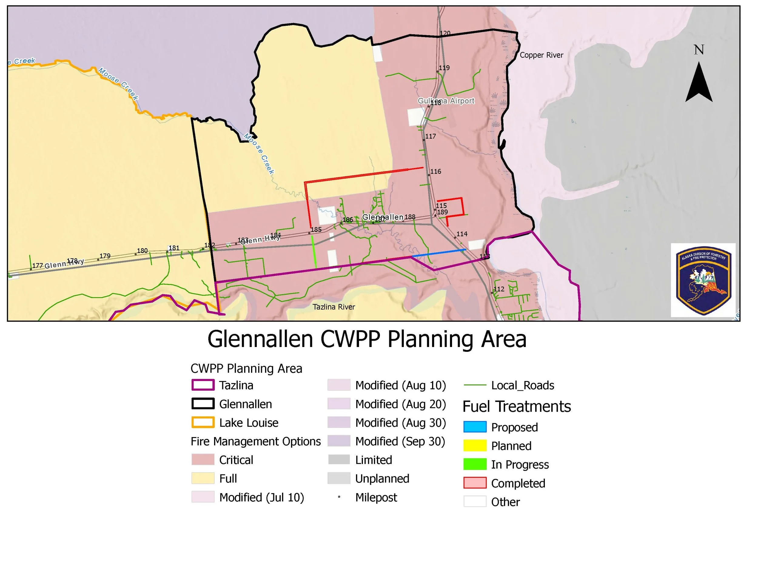
The Glennallen Community Wildfire Protection Planning Area covers from mile 120 to 113 of the Richardson Highway expanding to mile 182.5 of the Glenn Highway. The entirety of the Glennallen community and the infrastructure for the whole Copper River Basin is included in this planning area. Land ownership in this area includes private, state, BLM, Ahtna, native allotments, and lands managed by the University of Alaska.
Although the basin’s population is generally sprawled over many miles of highway and back-country, 439 of its’ people, 70 businesses, as well as public offices are located inside the Glennallen area including 3 bulk fuel companies and the Trans Alaska Pipeline (pump 11).
Copper Valley Electric and Copper Valley Telephone provide services for not only Glennallen, but for most of the Copper River Basin. School bus transportation for the entire Basin is also based out of Glennallen. Agencies such as the Bureau of Land Management, the Alaska Department of Fish and Game, Ahtna and the Chamber of Commerce are also located in Glennallen. KCAM radio, in Glennallen, was founded during the 1964 Alaska earthquake, it has been in place to serve the emergency communication needs of the Copper River Basin ever since.


CWPP Planning Area Map
Community planning areas include the wildland urban interface (WUI), defined as the area where human development meets and intermingles with undeveloped wildland and vegetative fuels. Included are lands designated as “Critical” and “Full” fire management options. Fire management options are assigned by jurisdictional agencies (landowners/managers), while protection agencies provide fire suppression responsibilities and initial response to wildfires. Alaska Division of Forestry and Fire Protection is the protection agency responsible for fire suppression in the Copper River Basin. See https://forestry.alaska.gov/fire/fireplans for more information on fire management options.
The goal of creating a community wildfire protection plan is to reduce the potential for disaster within the planning boundary by recognizing the hazards, prioritizing areas of protection, and developing a workable action plan with clear goals and objectives to mitigate the risks from wildfire, life, and property.
CWPP DOCUMENT LINK
CLICK BELOW
Explore the CWPP Planning Map App. with useful planning layers including CWPP areas, fire management options, land ownership, vegetation layers, and fire return interval models.
Community Wildfire Protection Plan survey results:
Thank you for participating


2nd CWPP Meeting in Glennallen
1st CWPP Meeting in Glennallen
Notes from past meetings
There are no past meetings’ notes yet.